
In-Car Navigation
Precision navigation for every journey
Our flagship navigation platform delivers centimeter-level positioning accuracy through multi-constellation GNSS, real-time HD map updates, and AI-powered route optimization. Supports 40+ languages and integrates seamlessly with vehicle HUD and instrument clusters.
Positioning Accuracy
< 30 cm
Map Update Frequency
Real-time
Supported Languages
40+
GNSS Constellations
GPS, GLONASS, BeiDou, Galileo
Product Details
The CUSP In-Car Navigation System is the result of over a decade of research in satellite positioning, high-definition mapping, and machine learning. Built on a modular architecture, it can be deployed across entry-level to luxury vehicle platforms with minimal integration effort. The system leverages fused data from GPS, GLONASS, BeiDou, and Galileo constellations, augmented by real-time kinematic (RTK) corrections, to achieve sub-30-centimeter accuracy even in urban canyons and dense foliage.
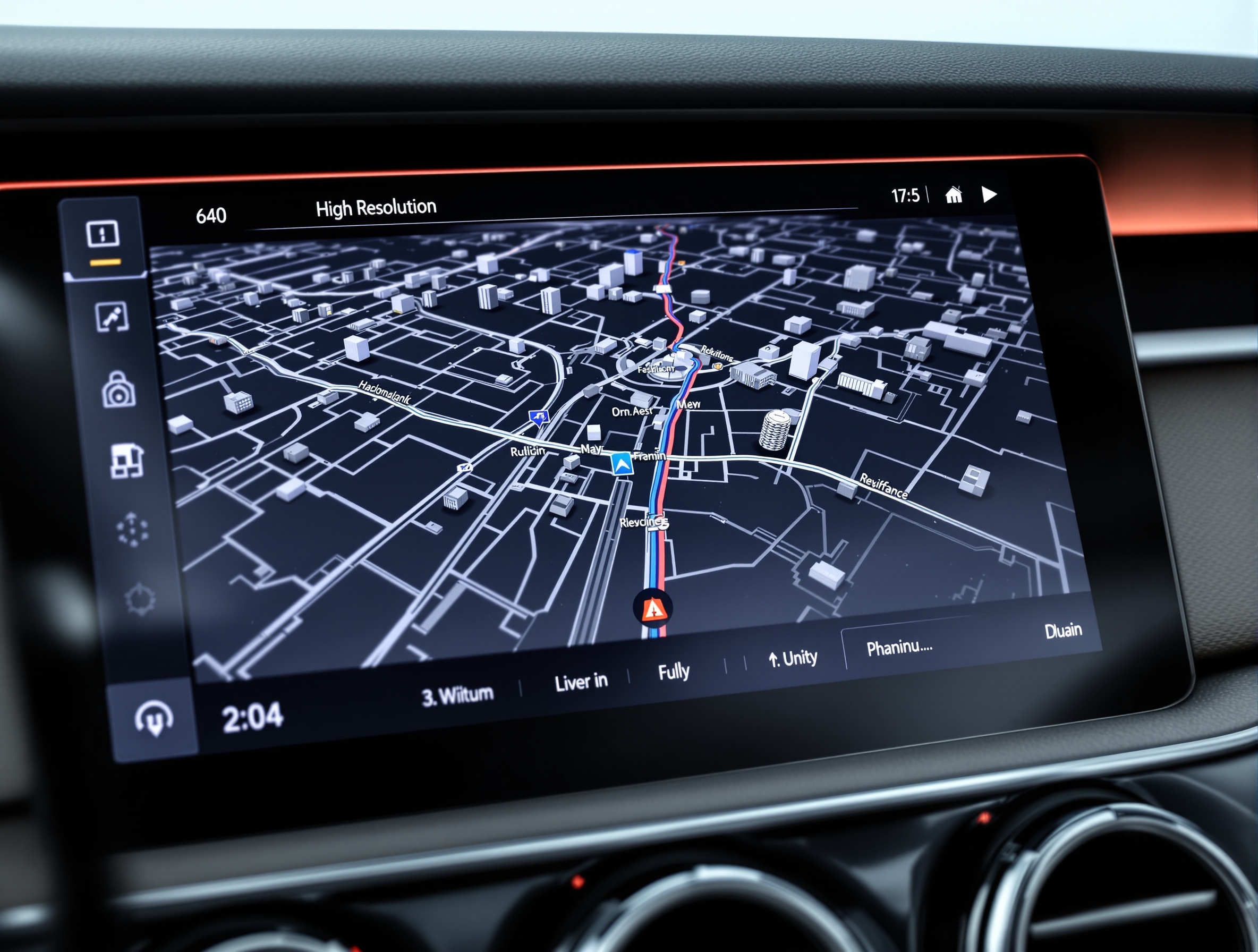
Our proprietary AI routing engine analyzes historical traffic patterns, weather data, and live congestion feeds to predict the optimal route up to 30 minutes in advance. The 3D map engine renders photorealistic building models and terrain contours at 60 frames per second, while the lane-level guidance system provides precise turn-by-turn instructions via both visual and haptic feedback.
All map data is delivered over-the-air via a secure, differential compression protocol that minimizes cellular data usage. The system supports 40+ languages with natural-language voice interaction, enabling drivers to set destinations, search POIs, and adjust preferences without taking their hands off the wheel.
Key Capabilities
Multi-constellation GNSS with RTK correction
AI-powered predictive route optimization
Real-time traffic and hazard alerts
Seamless OTA map updates
Voice interaction in 40+ languages
3D building rendering and lane guidance
Applications
Urban Commuting
Navigate dense city centers with real-time traffic rerouting and parking assistance.
Highway Cruising
Long-distance route planning with predictive fuel stops and EV charging station recommendations.
Off-Road & Remote
Offline topographic maps and trail guidance for adventure vehicles in areas with no cellular coverage.
Benchmarks
< 3 seconds
Cold Start Time
< 200 ms
Reroute Latency
60+ Countries
Map Coverage
12 Releases
Annual Map Updates
Technical Downloads
Technical Datasheet
PDF · 2.4 MB
Integration Guide
PDF · 5.1 MB
API Reference
PDF · 3.8 MB
Ready to Integrate?
Schedule a technical demo with our automotive integration specialists.